- 3:30 h
- 11.30 km
- 339 m
- 101 m
- 558 m
- 798 m
- 240 m
- Start: Thun
- Destination: Sigriswil
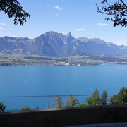
The first stage of the hike starts from Thun, the town with the medieval castle, and passes tranquil settlements like Hünibach and Aeschlen. Hikers soon reach and cross the spectacular bridge at Sigriswil, high above Lake Thun. The 340-metre bridge commanding panoramic views spans the Gummischlucht gorge at an altitude of 180 metres. Linking the villages of Aeschlen and Sigriswil, the bridge is the centrepiece of the entire Lake Thun circular trail project. A charge applies to cross the suspension bridge (reduced rate on presentation of a guest card); however, the view of the lake and the mountain peaks is free.
Stage 2 Sigriswil – Interlaken
Want to discover yet more hiking trails?
Learn more about the various hiking opportunities in the Bernese Oberland.
Good to know
Best to visit
Additional information
Author´s Tip / Recommendation of the author
Nearby


