- 1:10 h
- 4.38 km
- 146 m
- 1 m
- 652 m
- 797 m
- 145 m
- Start: Zweilütschinen, railway station
- Destination: Lauterbrunnen, Bahnhof Berner Oberland-Bahn
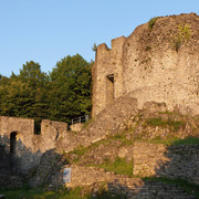
Zweilütschinen, the starting point of this hike, is where the Schwarze and Weisse (Black and White) Lütschine Rivers merge. The two rivers display striking differences in colour, caused by the types of bed load and sediment they carry. The arm flowing from the Lauterbrunnen Valley shimmers pale; the arm flowing from the Grindelwald Valley is significantly darker. A well-maintained hiking trail leads from the railway station along the Lütschine to the remains of a furnace where iron-ore was smelted centuries ago. Along the Schwarze and Weisse Lütschinen rivers; The trail continues to Sandweidli. At Sandweidli, the municipality of Lauterbrunnen's lowest point at 728 metres above sea level you will come across a fish ladder. This belongs to one of the Jungfrau Region's first renaturation and networking projects, implemented to facilitate the fish population's natural migration. You reach Lauterbrunnen station after a comfortable ascent, accompanied on your way by the pleasant sound of the nearby Weisse Lütschine.
Good to know
Best to visit
Directions
Equipment
Directions & Parking facilities
Additional information
(in the printed summer panoramic map of the Jungfrau Railways)
Safety guidelines
Nearby


